Blog on a Log
Wednesday, February 26, 2014
10% OFF All SUP boards and Kayaks at the Winnipeg Boat Show
All SUP boards and kayaks are on sale this weekend with special, boat show-only discounts on brand new 2014 models! Join us at the annual Winnipeg Boat Show Thursday, Feb 27th through Sunday, March 2nd in our new booth location on the first floor of the Winnipeg Convention Centre.
Thursday, February 27th 3 p.m. – 10 p.m.
Friday, February 28th noon – 10 p.m.
Saturday, March 1st 10 a.m. – 7 p.m.
Sunday, March 2nd 11 a.m. – 5 p.m.
Admission is $12, and kids under 12 get in free when accompanied by an adult.
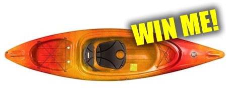
You might even be lucky enough to walk away with a boat for FREE! Stop by our booth to enter our draw to win a Perception Impulse kayak.
Sunday, February 9, 2014
Enter to Win a Free SPOT Satelite Messenger + a Year of Free Tracking!
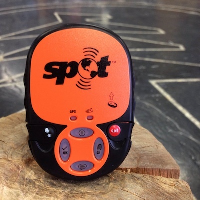

We're giving away a free SPOT Messenger Unit (Value $119.95) with one year of free tracking ($50 value) on our Facebook page! Entering is easy -
1. Like our contest photo on our Facebook page and
2. Leave a comment on the post saying where you would go adventuring with your SPOT unit if you won
Users can enter on either our Wilderness Supply Winnipeg or Wilderness Supply Thunder Bay page. Entries will only be counted once per person.
The contest runs until Friday, February 14 at 12:00 noon CST. One winner will be randomly selected from all valid entries on both Facebook pages, and announced with a tagged comment on the photo post. Winners must pick up their prize from a Wilderness Supply store location, or may choose to pay to have the unit shipped if they cannot pick up in store.
If the original winner does not contact Wilderness Supply within 48 hours, a second winner will be drawn. If the second winner does not claim their prize, a third redraw will not take place.
Happy adventuring!
This promotion is in no way sponsored, endorsed or administrated by, or associated with, Facebook.
Friday, February 7, 2014
What's Up in Winnipeg - the Outdoors Edition!
Temperatures may still be low, but there's lots going on in Winnipeg. Check out some of the great outdoor events taking place this weekend:
The Ice Donkey Adventure Race
Saturday, Feb 8
If you can't beat the winter, then join in the fun and adventure of a unique winter experience running, jumping and climbing through a 5km winter obstacle challenge! Registration has now closed, but you can always head down to cheer on the racers as they slide their way across the snowy finish line.
Iron Man Outdoor Curling Bonspiel
Friday, Feb 7 - Sunday, Feb 9
Bundle up and check out the hardy (or do we mean hearty!) outdoor curlers at the Iron Man Bonspiel. This Heart and Stroke Foundation fundraiser is open to curlers of all ages, and takes place along the Forks River Trail.
Skate & Stride
Sunday, Feb 9
Take a fun skate, stride or run down The Forks Riverwalk to raise awareness for mood disorders and bullying of Manitoba youth, followed by delicious goodies from Tall Grass Bakery! Registration is at 1pm at MTYP.
Winter Adventures at the Forks
Sunday, Feb 9
Head out to the Forks all afternoon to enjoy horse-drawn wagon rides, the Investors Group Aboriginal History and Art Program and free tips and instructions from a certified snowboard instructor on the forks toboggan hill.
Living Prairie Museum Snow Trek
Sunday, Feb 9
Enjoy Winnipeg's beautiful prairie outdoors on skis and snowshoes. There is free use of ski and snowshoe equipment - plus tips and guidance - from 12-4pm.
Manitoba Provincial Parks
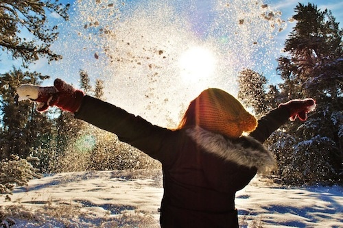
As we posted earlier this week, entry into Manitoba Provincial Parks is free all February. Get out and enjoy the natural beauty around Winnipeg with a walk, ski or snowshoe in one of our many parks. Don't have your own gear? Give us a call and book a rental!
Photo: Morgan Jane Photography
Monday, February 3, 2014
Free Entry into Manitoba Provincial Parks For February
Looking to make the most of our remaining winter days? Getting out just got a little bit easier - entry into Manitoba Provincial Parks is free for the entire month of February!
Conservation and Water Stewardship Minister Gord Mackintosh announced the break in fees on Saturday, suggesting that winter visits give Manitobans "a chance to see our province in a whole new way." Whether hiking, skiing, snowshoeing, or just going for a wander, winter is a great opportunity to get a different perspective on parks you may already know and love - or check out somewhere totally new!
Trail condition reports are updated every Thursday and can be found on the conservation website.
Read the original Conservation press release
CC Photo accessed via Travel Manitoba on Flickr
Thursday, January 30, 2014
Wild Trip Reports: Hiking Dove Crag and the Red Screes
At Wilderness Supply we encourage our staff to get out and use our gear as much as they can - it's the best way to make sure they know what to recommend to you! Our employees can be found adventuring all over the world, so today we're starting a new series: the Wild Trip Reports.
These posts will be a chance to feature some of our staff's adventures (and misadventures, no doubt!) wherever they may lead. Whether on the road, trail, or water, we love sharing our experiences with you, and hope you'll be able to use them for your own inspiration and planning...or perhaps just a little vicarious living!
Dove Craig and the Red Screes
Tripper: Buffy
Location: Ambleside, UK
Type: Hike
Date: January 13, 2014
When the alarm first went off and we peeked out the hostel window, Monday seemed the perfect day for a hike – there was a slight chill in the air but the skies looked clear, and we grabbed our daypacks and pressed on quickly, crossing our fingers the changeable British weather might decide to take a day off.
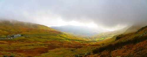
The first hour or two did grant us some lovely views back over the valley, with plenty of opportunity for photo taking as the skies lightened up. As we moved along and our thighs started their first bit of protesting, however, we could see bits of cloud moving in along the tops of the hills we were heading for... not the best omen!
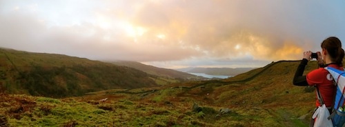
Lovely view back towards Ambleside during the first few km
Inevitably it wasn’t long before we’d hiked right up into the clouds and our gorgeous views had all but disappeared. A brief stop was made to layer up – windproof shells and backpack covers proving the most important items for managing the wet and blustery January chill. When we started to find small patches of snow heaped up along the wall base we knew things weren’t likely to turn much nicer that day (though the Canadian in me was ecstatic to finally see some evidence of proper winter in all this British wet).
The first portion of our hike followed an ancient stone wall, and while the pathway was quite wet in parts at least it was obvious—plus my Gore-tex shoes had good opportunity to prove their worth. As we neared our turnoff away from the wall dozens of pathways criss-crossed the hill and it became difficult to distinguish goat routes and old river beds from actual paths in the mounting fog. We walked a few hundred meters past our turnoff before noting the mistake, and a quick huddle behind the protective shelter of the wall gave a much needed opportunity to don mitts and toques, re-check the map and get back on track. On a more featureless landscape the poor visibility might have been cause for concern, but thankfully the path when found followed along an old fence line, giving a good bearing for staying on trail (or retracing our footsteps if we had turned out to be wrong!)
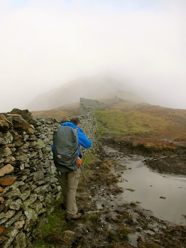
Getting colder... and foggier! Time to layer up and double check the map
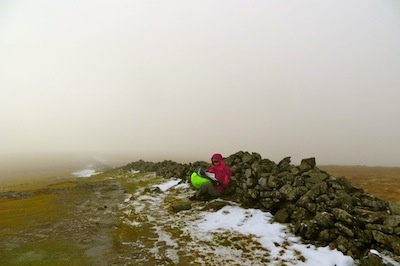
We pushed on up to the highest point of our hike, where the wet conditions had led to frozen pathways that required some careful stepping. Reaching the summit didn’t bring any views, but did reveal an old surveyor’s trig point, which turned out to have been used by Rick’s father when mapping the Lake District back in the 70s.
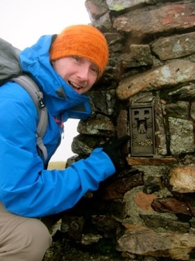
Trig point!
The Red Screes proved the most hazard part of the hike, dropping over 200 meters down worn, rock-cut steps on the hillside. The icy conditions gave us some pause here as well, but cautious footing got us down without much trouble, and part way down the slope the clouds cleared just enough to show us our oasis at the hill’s base: the Kirkstone Pass Inn!
First view of the pub - down across the valley from the Screes
This old pub was has been around for over 500 years, and sits at a height of 454 meters (the highest in Cumbria). A 20 minute break by the warm fire gave us a chance to thaw out and down a much anticipated pint, and though we may have looked somewhat scruffy the locals seemed quite used to the ways of smelly hill walkers. The short regroup was followed by a last easy 5 kilometers downhill back to town, where a greatly anticipated dinner was calling.
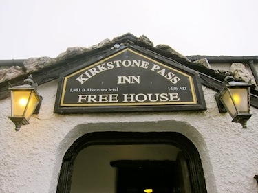
Older than Canada...by quite a bit!
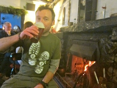
Ahh... a well earned bit of refreshment and a roaring fire
Trip Length: ~18 kilometers with 1050 meters ascent (6.5-7.5 hours, plus obligatory pub break)
How to get there: From Ambleside follow Nook Lane out of town until you come to Nook Farm. Head through the gate and up the path past Low Sweden Bridge.
Gear List
On my Back
- Smartwool medium PhD socks

- Salomon Ellipse Mid Goretex Boots
- IoBio lightweight merino tights
- The North Face Horizon Tempest pants
- Smartwool Midweight Zip Neck
- Patagonia Triolet Jacket
- Deuter Compact EXP 12 with rain cover
In my Bag
- Topo map of route ("Handi Hikes Map #10: Walk the Fairfield Horseshoe")
- Nalgene 32 oz. Wide Mouth Canteen (x2, full)
- Steripen AdventurerOpti
- Granola bars, peperoni sticks, chocolate, candy
- The North Face Jackson Hybrid Jacket
- North Face Redpoint Mitts
- Toque
- Extra pair of Smartwool socks
- Toilet paper
- Plastic bag for garbage
- Duct tape
- First Aid Kit
- Emergency cell phone
- Headlamp
- Camera (in waterproof Pelican 1010 case)